Arkansas, the “Natural State,” lives up to its name with a dazzling array of pristine lakes, each offering a unique slice of paradise. Imagine waking to the gentle lapping of water, the scent of pine, and the promise of a day filled with adventure, whether you’re casting a line, paddling serene waters, or simply soaking in the sun on a quiet shore. From the crystal-clear depths of the Ozarks to the tranquil bayous of the Delta, these aquatic jewels are more than just bodies of water; they are vibrant ecosystems and playgrounds for every type of traveler.
This guide will whisk you away on a journey through Arkansas’s 15 best lakes, unveiling their hidden gems, practical tips, and detailed cost breakdowns to help you plan your perfect escape. The best time to visit is typically spring (April-May) or fall (September-October) when the weather is mild and the natural beauty is at its peak, though summer offers prime swimming and boating opportunities. Prepare to be captivated by Arkansas’s watery wonders!
💰 Travel Cost Overview
Category
Budget
Mid-range
Luxury
Accommodation (per night)
$60-100 (Camping/Basic Motel)
$120-200 (Mid-range Hotel/Cabin)
$250-500+ (Resort/Luxury Lodge)
Food & Dining (per day)
$25-40 (Groceries/Fast Food)
$50-80 (Casual Restaurants)
$100-150+ (Fine Dining/Specialty)
Transportation (per day)
$10-20 (Local bus/Minimal driving)
$40-70 (Personal car/Car rental)
$80-120+ (Premium car rental/Boat rental)
Activities & Attractions (avg. per day)
$10-25 (Free hikes/Low-cost park entry)
$30-70 (Boat rentals/Guided tours)
$80-150+ (Specialized tours/Gear rental)
Total Daily Budget
$95-185
$240-420
$510-920+
Weekly Budget Estimates
$665-1295
$1680-2940
$3570-6440+
Bull Shoals Lake; Marion County
Bull Shoals Lake, sprawling across the Arkansas-Missouri border in the scenic Ozark Mountains, is often hailed as one of the cleanest and clearest lakes in the United States. Its deep, sapphire waters are a testament to its pristine condition, making it a diver’s dream and a paradise for anglers seeking trophy-sized bass, crappie, and walleye. You will discover over 1,000 miles of rugged, tree-lined shoreline, perfect for secluded coves and hidden swimming spots. The lake is formed by the massive Bull Shoals Dam, an impressive engineering marvel that offers tours and panoramic views.
Beyond the water, the surrounding Bull Shoals-White River State Park provides excellent camping, hiking trails, and a marina. This destination is perfect for families seeking a peaceful retreat, avid fishermen looking for a challenge, and anyone who appreciates unspoiled natural beauty. Its history is tied to the dam’s construction in the 1950s, which transformed the landscape and created this recreational haven. Visit in the spring or fall for ideal weather and fewer crowds, though summer brings vibrant boating activity.
💰 Quick Cost Guide
💵
Entry
Free to access the lake itself. Bull Shoals-White River State Park day-use fee is $5 per vehicle.
🅿️
Parking
Free at most public access points; $3-5 at some boat ramps or state park lots.
🍽️
Dining
$15-30 per person at local diners and casual restaurants in Bull Shoals or Mountain Home.
💳
Payment
Cash and card widely accepted. Some smaller bait shops or concessions might be cash-only.
📍 Visitor Information
🕐
Peak Hours
Summer weekends, particularly 10am-4pm, are busiest for boating and swimming. Weekdays are generally quieter.
💰
Cost
Lake access is generally free. State Park day-use fees may apply for specific areas, typically $3-5 per vehicle. Boat rentals vary widely.
⏱️
Duration
A full day or multiple days are recommended to truly experience the lake and surrounding park.
📅
Best Time to Visit
Spring (April-May) for fishing and mild weather; Fall (September-October) for stunning foliage and comfortable temperatures.
🎯
What to Expect
Crystal-clear water, excellent fishing, diverse water sports, camping, and scenic views of the Ozarks.
💡
Insider Tip
Take a tour of the Bull Shoals Dam for an impressive look at its scale and a bit of local history. Also, check out the nearby Mountain Village 1890 for a step back in time.
🚗
Parking
Ample parking available at marinas, boat ramps, and state park facilities. Fees may apply at some ramps ($3-5).
♿
Accessibility
Many state park facilities, including visitor centers and some fishing piers, are accessible. Some boat ramps offer accessible features.
DeGray Lake; Clark & Hot Spring Counties
DeGray Lake, located in the foothills of the Ouachita Mountains, stands out as Arkansas’s first State Park Resort, offering a unique blend of natural beauty and upscale amenities. Its clear, warm waters are perfect for swimming, wakeboarding, and even scuba diving, with several submerged structures to explore. What makes DeGray truly special is the island golf course, a championship layout accessible by a causeway, offering stunning lake views at every hole.
You can enjoy guided horseback riding, hiking trails through diverse forest, and excellent fishing for bass, crappie, and catfish. The park also hosts interpretive programs, boat tours, and even a fishing guide service. This lake is ideal for families seeking a resort-style vacation with plenty of activities, couples looking for a relaxing escape, and anyone who enjoys a blend of outdoor adventure and comfort. Its resort status ensures well-maintained facilities and a wide range of services.
💰 Quick Cost Guide
💵
Entry
Free for lake access. DeGray Lake Resort State Park charges $5 per vehicle for day-use areas.
🅿️
Parking
Free at resort and most public access points.
🍽️
Dining
$20-40 per person at the resort restaurant; $12-25 at casual eateries in Arkadelphia or Malvern.
💳
Payment
Cash and all major credit cards are accepted at the resort and most park facilities.
📍 Visitor Information
🕐
Peak Hours
Summer weekends, especially around the resort and marina, are very busy from 9am-5pm. Weekdays offer a more serene experience.
💰
Cost
Lake access is free. State Park Resort amenities like golf, boat rentals, and specific tours have separate fees.
⏱️
Duration
A weekend getaway or longer is recommended to fully enjoy the resort and lake activities.
📅
Best Time to Visit
Late spring (May-June) and early fall (September) for pleasant weather and fewer crowds than peak summer.
🎯
What to Expect
A resort-style lake experience with golf, diverse water sports, guided activities, and beautiful scenery.
💡
Insider Tip
Book a sunset cruise on the lake for breathtaking views and a relaxing evening. Also, consider attending one of the park’s interpretive programs for local insights.
🚗
Parking
Ample parking available at the resort, lodge, marinas, and various park access points. Parking at the resort is typically free for guests.
♿
Accessibility
The resort lodge, many cabins, dining facilities, and some trails are designed to be accessible. Accessible fishing piers are also available.
Greers Ferry Lake; Cleburne & Van Buren Counties
Greers Ferry Lake, nestled in the scenic foothills of the Ozarks, is renowned for its extraordinarily clear, cold waters, which are fed by the Little Red River. This clarity makes it a prime spot for swimming, scuba diving, and particularly, striped bass fishing, for which it holds several world records. The lake’s irregular shoreline boasts numerous coves, bluffs, and sandy beaches, offering endless opportunities for exploration and relaxation. You can explore the impressive Greers Ferry Dam, which holds back the waters, or visit the nearby William Carl Garner Visitor Center to learn about the lake’s history and ecology.
Beyond the water, enjoy hiking trails, camping, and picnicking. The lake is divided into two distinct sections, connected by a narrow channel, offering varied experiences. It’s a fantastic destination for serious anglers, families looking for clean swimming areas, and nature lovers drawn to its pristine environment. The lake was created in the 1960s, bringing significant economic and recreational development to the region.
💰 Quick Cost Guide
💵
Entry
Free for lake access. State park day-use areas typically charge $5 per vehicle.
🅿️
Parking
Free at most public access points; $3-5 at some boat ramps.
🍽️
Dining
$12-25 per person at casual restaurants in Heber Springs or Fairfield Bay.
💳
Payment
Cash and card widely accepted.
📍 Visitor Information
🕐
Peak Hours
Summer weekends, especially around public beaches and marinas, from 11am-6pm. Weekdays are more peaceful.
💰
Cost
Lake access is free. Public park areas and boat ramps may have small day-use fees.
⏱️
Duration
Plan for a full day of water activities, or a multi-day stay to explore different sections and surrounding towns like Heber Springs.
📅
Best Time to Visit
Late spring (May) and early fall (September-October) for excellent fishing and comfortable temperatures. Summer is ideal for swimming.
🎯
What to Expect
Very clear, cold water, world-class striped bass fishing, beautiful bluffs, and numerous recreational opportunities.
💡
Insider Tip
Visit the “Sugarloaf Mountain National Nature Trail” for a rewarding hike and panoramic views of the lake. Also, check out the annual “Heber Springs Cardboard Boat Race” for unique entertainment.
🚗
Parking
Ample parking at public access points, marinas, and state parks. Some boat ramps may have a $3-5 launch fee.
♿
Accessibility
Some public recreation areas and visitor centers offer accessible restrooms and paved pathways. Accessible fishing piers are available at certain spots.
Beaver Lake; Benton & Carroll Counties
Beaver Lake, carved into the rugged Ozark Mountains of Northwest Arkansas, is a true gem known for its stunning limestone bluffs, clear waters, and abundant fishing opportunities. As the primary drinking water source for much of the region, its pristine condition is carefully maintained, offering excellent conditions for swimming, boating, and scuba diving amongst submerged timber and rock formations. You will find over 487 miles of picturesque shoreline, dotted with numerous parks, campgrounds, and marinas.
The lake is particularly famous for its bass fishing – both largemouth and smallmouth – as well as crappie and bream. Hiking trails wind through the surrounding bluffs, providing breathtaking vistas. Beaver Lake is an ideal destination for outdoor enthusiasts, families seeking active water adventures, and anglers of all skill levels. Its creation in the 1960s with the construction of Beaver Dam transformed the region, providing flood control, hydroelectric power, and immense recreational value.
💰 Quick Cost Guide
💵
Entry
Free for lake access. Corps of Engineers day-use areas typically charge $5 per vehicle.
🅿️
Parking
Free at most public access points; $5 at some Corps of Engineers parks/boat ramps.
🍽️
Dining
$15-30 per person at casual restaurants in Eureka Springs, Rogers, or Springdale.
💳
Payment
Cash and card widely accepted. Some smaller vendors may prefer cash.
📍 Visitor Information
🕐
Peak Hours
Summer weekends, especially holidays, from 10am-5pm can be very crowded at popular boat ramps and swimming areas. Mornings are best for fishing.
💰
Cost
Lake access is free. Corps of Engineers parks and boat ramps may charge day-use fees.
⏱️
Duration
A full day allows for a good taste, but a multi-day trip is recommended to explore different coves and activities.
📅
Best Time to Visit
Late spring (May) for fishing and mild weather; early fall (September-October) for beautiful foliage and comfortable temperatures.
🎯
What to Expect
Clear water, dramatic limestone bluffs, excellent bass fishing, and diverse water recreation.
💡
Insider Tip
Explore the “War Eagle Cavern,” a natural cave system located on the lake’s shores, accessible by boat or car, for a unique underground adventure.
🚗
Parking
Ample parking at various Corps of Engineers parks, marinas, and public access points. Day-use fees of $5 per vehicle may apply at some locations.
♿
Accessibility
Many Corps of Engineers recreation areas offer accessible restrooms, picnic areas, and paved pathways. Some boat ramps and fishing piers are also accessible.
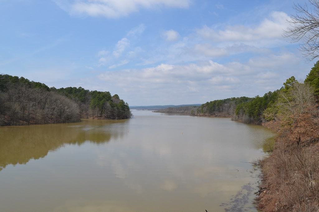
Norfork Lake; Baxter County
Norfork Lake, a vast expanse of clear, deep water in the Arkansas Ozarks, is a fishing paradise, particularly renowned for its diverse species including striped bass, largemouth bass, walleye, and crappie. With over 500 miles of shoreline and numerous coves, it offers endless opportunities for anglers, boaters, and swimmers seeking solitude or adventure. The lake’s clarity makes it excellent for scuba diving, with several submerged towns and structures to explore, offering a unique underwater experience.
You can also visit the Norfork Dam, an impressive structure that created the lake in the 1940s, providing flood control and hydroelectric power. Surrounding the lake are various campgrounds, hiking trails, and picnic areas, making it a comprehensive outdoor destination. Norfork Lake is perfect for serious fishermen, divers, and families who appreciate a quieter, less commercialized lake experience focused on natural beauty and abundant wildlife. Its history as one of the first major impoundments in the Ozarks adds to its allure.
💰 Quick Cost Guide
💵
Entry
Free for lake access. Corps of Engineers day-use areas typically charge $5 per vehicle.
🅿️
Parking
Free at most public access points; $5 at some Corps of Engineers parks/boat ramps.
🍽️
Dining
$15-30 per person at local diners and casual restaurants in Mountain Home or Norfork.
💳
Payment
Cash and card widely accepted.
📍 Visitor Information
🕐
Peak Hours
Summer weekends, especially 10am-4pm, can see more boat traffic. Early mornings are best for fishing, and weekdays are generally less crowded.
💰
Cost
Lake access is free. Corps of Engineers parks and boat ramps may have small day-use fees.
⏱️
Duration
A minimum of a full day to enjoy the water; multiple days are ideal for comprehensive fishing or diving trips.
📅
Best Time to Visit
Spring (April-May) for excellent fishing and comfortable weather; Fall (September-October) for stunning foliage.
🎯
What to Expect
Deep, clear water, exceptional fishing, diverse diving opportunities, and a tranquil, natural setting.
💡
Insider Tip
If you’re a diver, look for the submerged foundation of the old Norfork town for a unique historical exploration. For anglers, hire a local guide for the best chance at striped bass.
🚗
Parking
Ample parking at Corps of Engineers parks, marinas, and public access points. Some boat ramps may have a $3-5 launch fee.
♿
Accessibility
Many Corps of Engineers recreation areas offer accessible facilities like restrooms and picnic sites. Some fishing piers are also accessible.
Lake Ouachita; Garland & Montgomery Counties
Lake Ouachita, often called the “Diamond Lake” for its crystal-clear, deep waters and abundant quartz crystals found along its shores, is Arkansas’s largest lake and arguably its most pristine. Nestled within the Ouachita National Forest, it boasts over 700 miles of undeveloped shoreline, making it a haven for nature lovers and those seeking solitude. You will discover countless islands, perfect for primitive camping, and numerous hidden coves ideal for swimming, snorkeling, and scuba diving.
The lake is renowned for its excellent bass and crappie fishing, and you might even spot an eagle overhead. Lake Ouachita State Park offers modern camping, cabins, and interpretive programs, including guided lake tours and nature walks. This destination is perfect for wilderness adventurers, serious anglers, families who love camping, and anyone desiring an escape into untouched natural beauty. Its designation as a “Corps of Engineers Cleanest Lake” further solidifies its reputation as a natural wonder.
💰 Quick Cost Guide
💵
Entry
Free for lake access. Lake Ouachita State Park day-use fee is $5 per vehicle.
🅿️
Parking
Free at most public access points; $5 at state park lots or some boat ramps.
🍽️
Dining
$15-30 per person at casual restaurants in Mountain Pine or Hot Springs (a short drive away).
💳
Payment
Cash and card widely accepted at state park facilities and marinas.
📍 Visitor Information
🕐
Peak Hours
Summer weekends, particularly 10am-5pm, see increased boat traffic. Weekdays and early mornings are quieter.
💰
Cost
Lake access is free. State Park facilities and specific activities (e.g., boat tours) have fees.
⏱️
Duration
Multiple days are highly recommended to explore the vastness of the lake and its many islands.
📅
Best Time to Visit
Spring (April-May) for pleasant weather and fishing; Fall (September-October) for stunning foliage and comfortable temperatures.
🎯
What to Expect
Pristine, crystal-clear water, abundant islands, excellent fishing, primitive camping, and a true wilderness feel.
💡
Insider Tip
Take a guided “Lake Ouachita Crystal Mine” tour to dig for your own quartz crystals. Also, explore the “Geo-Float Trail,” a unique water-based interpretive trail.
🚗
Parking
Ample parking at Lake Ouachita State Park, marinas, and various public access points. State Park day-use fees of $5 per vehicle may apply.
♿
Accessibility
Lake Ouachita State Park offers accessible restrooms, cabins, and some paved paths. Accessible fishing piers are available.
Lake Dardanelle; Pope, Yell, Logan, Johnson & Franklin Counties
Lake Dardanelle, a sprawling 34,300-acre reservoir on the Arkansas River, is a major hub for fishing tournaments and recreational boating, offering a diverse experience from wide-open waters to secluded coves. It’s particularly famous for its bass fishing, attracting anglers from across the nation, and hosts numerous professional fishing events. You will find excellent opportunities for water skiing, jet skiing, and pleasure boating.
Lake Dardanelle State Park, located on both sides of the lake, provides modern camping, a visitor center with aquariums, and interpretive programs. The lake’s connection to the Arkansas River creates a unique environment, with varied aquatic life and birdwatching opportunities, especially during migration seasons. This lake is perfect for competitive anglers, active boaters, birdwatchers, and families looking for a lively lake experience with good amenities. Its role as part of the McClellan-Kerr Arkansas River Navigation System highlights its importance for both recreation and commerce.
💰 Quick Cost Guide
💵
Entry
Free for lake access. Lake Dardanelle State Park day-use fee is $5 per vehicle.
🅿️
Parking
Free at most public access points; $5 at state park lots or some boat ramps.
🍽️
Dining
$12-25 per person at casual restaurants in Russellville or Dardanelle.
💳
Payment
Cash and card widely accepted.
📍 Visitor Information
🕐
Peak Hours
Weekends, especially during fishing tournaments, from 9am-6pm. Weekdays are generally less crowded.
💰
Cost
Lake access is free. State Park day-use fees may apply. Boat rentals and specific activities have separate costs.
⏱️
Duration
A full day is sufficient for basic enjoyment; multiple days are recommended for fishing trips or exploring both state park sections.
📅
Best Time to Visit
Spring (March-May) for prime fishing and comfortable weather; Summer (June-August) for water sports.
🎯
What to Expect
Excellent bass fishing, active boating, diverse birdwatching, and well-maintained state park facilities.
💡
Insider Tip
Visit the Lake Dardanelle State Park visitor center in Russellville, which features large aquariums showcasing local fish species. Check their schedule for fishing clinics.
🚗
Parking
Ample parking at Lake Dardanelle State Park, marinas, and public boat ramps. State Park day-use fees of $5 per vehicle may apply.
♿
Accessibility
Lake Dardanelle State Park facilities, including visitor centers, restrooms, and some fishing piers, are accessible.
Lake Conway; Faulkner County
Lake Conway, located just minutes from Little Rock in Faulkner County, holds the distinction of being the largest Game and Fish Commission lake in the United States, designed primarily for fishing. Its shallow, cypress-filled waters are a haven for crappie, bass, bream, and catfish, making it an angler’s dream, especially for those who enjoy fishing from a small boat or a pier. The lake’s unique structure, with numerous submerged stumps and timber, provides ideal habitat for fish, though it requires careful navigation.
You will find several public access points, boat ramps, and fishing docks. Beyond fishing, the lake offers opportunities for birdwatching, particularly for waterfowl, and quiet paddling among the cypress trees. Lake Conway is perfect for local anglers, families looking for an easy day trip from the city, and anyone who appreciates a tranquil, natural setting focused on fishing. Its shallow depths and abundant aquatic vegetation create a unique ecosystem.
💰 Quick Cost Guide
💵
Entry
Free for lake access.
🅿️
Parking
Free at most public access points. Private marinas may charge $5-10 for boat launch and parking.
🍽️
Dining
$10-20 per person at casual eateries in Conway.
💳
Payment
Cash and card widely accepted. Smaller marinas might prefer cash for launch fees.
📍 Visitor Information
🕐
Peak Hours
Weekends, especially early mornings, are busiest for fishing. Weekdays offer more solitude.
💰
Cost
Lake access is free. Boat launch fees may apply at private marinas.
⏱️
Duration
Half a day to a full day is sufficient for a fishing trip or a peaceful paddle.
📅
Best Time to Visit
Spring (March-May) for prime crappie and bass fishing; Fall (September-October) for comfortable weather and good fishing.
🎯
What to Expect
Excellent fishing, shallow cypress-filled waters, peaceful paddling, and abundant birdlife.
💡
Insider Tip
Due to the shallow water and stumps, a smaller boat or a kayak/canoe is often more practical than a large motorboat. Check local bait shops for up-to-date fishing reports.
🚗
Parking
Ample parking available at public boat ramps and private marinas. Boat launch fees typically apply.
♿
Accessibility
Some public boat ramps and fishing piers offer accessible features.
Lake Greeson, Pike County
Lake Greeson, nestled in the scenic Ouachita Mountains, is a multi-purpose lake renowned for its clear waters, excellent fishing, and vibrant recreational opportunities. It’s particularly famous for its rainbow trout fishing below the dam on the Little Missouri River, and for its diverse warm-water species like bass, crappie, and catfish within the lake itself. What makes Lake Greeson truly unique are the opportunities for diamond hunting at the nearby Crater of Diamonds State Park, making it a perfect base for a treasure-seeking adventure.
You can enjoy swimming, boating, waterskiing, and exploring numerous coves and islands. The lake also offers several Corps of Engineers parks with camping, picnicking, and hiking trails. This destination is ideal for families combining a lake vacation with a unique attraction, anglers seeking diverse fishing, and outdoor enthusiasts who appreciate clear water and mountain scenery. Its creation in the 1950s provided flood control, hydroelectric power, and a thriving recreational area.
💰 Quick Cost Guide
💵
Entry
Free for lake access. Corps of Engineers day-use areas typically charge $5 per vehicle. Crater of Diamonds State Park entry is $10 adults, $6 children.
🅿️
Parking
Free at most public access points; $5 at some Corps of Engineers parks/boat ramps.
🍽️
Dining
$12-25 per person at casual eateries in Murfreesboro or Daisy.
💳
Payment
Cash and card widely accepted.
📍 Visitor Information
🕐
Peak Hours
Summer weekends, especially 10am-5pm, are busiest. Weekdays are generally quieter.
💰
Cost
Lake access is free. Corps of Engineers parks and boat ramps may have small day-use fees. Crater of Diamonds State Park has a separate entry fee.
⏱️
Duration
A full day for lake activities, or 2-3 days to combine with diamond hunting and exploring the surrounding area.
📅
Best Time to Visit
Spring (April-May) for pleasant weather and good fishing; Summer (June-August) for water sports; Fall (September-October) for foliage.
🎯
What to Expect
Clear water, excellent fishing (including trout below the dam), proximity to diamond hunting, and beautiful mountain scenery.
💡
Insider Tip
Visit Crater of Diamonds State Park early in the morning for the best chance to find diamonds. Also, explore the “Daisy State Park” area for unique hiking trails.
🚗
Parking
Ample parking available at Corps of Engineers parks, marinas, and public access points. Some boat ramps may have a $3-5 launch fee.
♿
Accessibility
Many Corps of Engineers recreation areas offer accessible restrooms, picnic sites, and paved pathways. Some fishing piers are also accessible.
Millwood Lake; Little River County
Millwood Lake, located in Southwest Arkansas near the Texas border, is a vast, shallow reservoir known as one of the state’s premier fishing destinations, particularly for largemouth bass, crappie, and catfish. Its unique character comes from the abundant standing timber and aquatic vegetation, creating an ideal habitat for fish but requiring skilled navigation. What makes Millwood special is its reputation as a birdwatching paradise, attracting numerous species of waterfowl, wading birds, and raptors, including bald eagles, especially during migration.
You will find several public access points, boat ramps, and Millwood State Park, which offers modern camping and excellent birding opportunities. The lake’s shallow nature makes it less ideal for traditional water sports like waterskiing but perfect for kayakers, canoers, and anglers who appreciate its rich biodiversity. It’s an excellent choice for serious birdwatchers, dedicated anglers, and anyone seeking a tranquil, nature-focused experience. The lake was formed in the 1960s for flood control and recreation.
💰 Quick Cost Guide
💵
Entry
Free for lake access. Millwood State Park day-use fee is $5 per vehicle.
🅿️
Parking
Free at most public access points; $5 at state park lots or some boat ramps.
🍽️
Dining
$10-20 per person at casual eateries in Ashdown or Texarkana (a short drive away).
💳
Payment
Cash and card widely accepted.
📍 Visitor Information
🕐
Peak Hours
Weekends, especially early mornings for fishing, are busiest. Weekdays offer more solitude. Birdwatching is best at dawn and dusk.
💰
Cost
Lake access is free. State Park day-use fees may apply.
⏱️
Duration
A full day for fishing or birdwatching; multiple days for a comprehensive natural exploration.
📅
Best Time to Visit
Spring (March-May) for prime fishing and bird migration; Fall (September-November) for excellent birdwatching.
🎯
What to Expect
Exceptional fishing (especially bass), world-class birdwatching, abundant standing timber, and a serene, wild atmosphere.
💡
Insider Tip
Bring a good pair of binoculars for birdwatching! Consider hiring a local fishing guide to navigate the timber and find the best spots.
🚗
Parking
Ample parking available at Millwood State Park and public boat ramps. State Park day-use fees of $5 per vehicle may apply.
♿
Accessibility
Millwood State Park offers accessible restrooms, picnic areas, and some paved paths. Accessible fishing piers are available.
Lake Chicot; Chicot County
Lake Chicot, located in Southeast Arkansas, is the state’s largest natural lake and North America’s largest oxbow lake, formed by a meander of the Mississippi River that was cut off centuries ago. Its unique crescent shape and rich history make it a fascinating destination. The lake is known for its excellent fishing, particularly for crappie, bass, and catfish, thriving in its fertile, nutrient-rich waters.
You will experience a distinct Delta landscape, with cypress trees lining the shores and abundant birdlife, including pelicans and eagles. Lake Chicot State Park offers modern camping, cabins, and interpretive boat tours that delve into the lake’s formation and ecosystem. Its historical significance, including early steamboat navigation and plantation history, adds another layer to its appeal. This lake is perfect for anglers seeking a unique fishing environment, birdwatchers, history buffs, and families who enjoy a tranquil, educational outdoor experience.
💰 Quick Cost Guide
💵
Entry
Free for lake access. Lake Chicot State Park day-use fee is $5 per vehicle.
🅿️
Parking
Free at most public access points; $5 at state park lots or some boat ramps.
🍽️
Dining
$10-20 per person at casual eateries in Lake Village.
💳
Payment
Cash and card widely accepted.
📍 Visitor Information
🕐
Peak Hours
Weekends, especially during fishing seasons, from 9am-5pm. Weekdays are quieter.
💰
Cost
Lake access is free. State Park day-use fees and boat tour fees apply.
⏱️
Duration
A full day for lake activities and park exploration; multiple days for a more relaxed visit.
📅
Best Time to Visit
Spring (March-May) for good fishing and bird migration; Fall (September-October) for comfortable weather.
🎯
What to Expect
A large natural oxbow lake, excellent fishing, rich birdlife, and a glimpse into Delta history.
💡
Insider Tip
Take the guided interpretive boat tour offered by Lake Chicot State Park to learn about the lake’s unique geology and ecology.
🚗
Parking
Ample parking available at Lake Chicot State Park and public boat ramps. State Park day-use fees of $5 per vehicle may apply.
♿
Accessibility
Lake Chicot State Park facilities, including visitor center, restrooms, and some cabins, are accessible. Accessible fishing piers are available.
Lake Maumelle; Pulaski County
Lake Maumelle, a pristine drinking water reservoir for the city of Little Rock, offers a serene and beautiful escape just a short drive from the state capital. While swimming is prohibited to protect water quality, the lake is a popular destination for sailing, kayaking, canoeing, and fishing for bass, crappie, and catfish. What makes Lake Maumelle unique is its strict environmental protection, ensuring incredibly clear waters and a peaceful, uncrowded atmosphere.
You will enjoy stunning views of the surrounding Ouachita Mountains and Pinnacle Mountain State Park, which borders a portion of the lake. The area is also excellent for birdwatching, with bald eagles frequently spotted, especially in winter. This lake is perfect for paddlers, sailors, anglers who enjoy catch-and-release, and anyone seeking a tranquil, scenic outdoor experience close to urban amenities. Its role as a vital water source underscores its importance and pristine condition.
💰 Quick Cost Guide
💵
Entry
Free for lake access.
🅿️
Parking
Free at most public access points. Private marinas may charge $5-10 for boat launch and parking.
🍽️
Dining
$15-30 per person at casual restaurants in Little Rock or Maumelle.
💳
Payment
Cash and card widely accepted.
📍 Visitor Information
🕐
Peak Hours
Weekends, especially mornings for paddling and fishing, from 8am-2pm. Weekdays are very quiet.
💰
Cost
Lake access is free. Boat launch fees may apply at specific marinas.
⏱️
Duration
A half-day to a full day is sufficient for paddling or fishing.
📅
Best Time to Visit
Spring (April-May) and Fall (September-October) for comfortable weather; Winter for best bald eagle viewing.
🎯
What to Expect
Pristine, clear water (no swimming), excellent paddling and sailing, good fishing, and stunning mountain views.
💡
Insider Tip
Rent a kayak or canoe and paddle into one of the lake’s quiet coves for exceptional birdwatching and solitude. Combine your visit with a hike up Pinnacle Mountain for panoramic views of the lake.
🚗
Parking
Available at marinas and public access points. Boat launch fees typically apply.
♿
Accessibility
Some marinas and boat launch areas may offer accessible restrooms.
White Oak Lake; Nevada & Ouachita Counties
White Oak Lake, located in Southwest Arkansas, is a serene and relatively undeveloped lake known for its excellent fishing and abundant wildlife, particularly in its two distinct sections: Upper White Oak Lake and Lower White Oak Lake. The lake’s shallow, fertile waters are teeming with largemouth bass, crappie, and bream, making it a favorite among local anglers. What makes White Oak Lake unique is its tranquil, uncrowded atmosphere and the extensive surrounding bottomland hardwood forest, which provides fantastic opportunities for birdwatching and wildlife viewing, including deer and waterfowl.
You will find several public access points and boat ramps, with the state park offering camping and picnic facilities. This lake is ideal for anglers seeking a peaceful fishing experience, birdwatchers, and families looking for a quiet, nature-focused getaway away from the hustle and bustle. Its natural beauty and rustic charm offer a genuine escape into the Arkansas outdoors.
💰 Quick Cost Guide
💵
Entry
Free for lake access. White Oak Lake State Park day-use fee is $5 per vehicle.
🅿️
Parking
Free at most public access points; $5 at state park lots or some boat ramps.
🍽️
Dining
$10-20 per person at casual eateries in Bluff City or Camden.
💳
Payment
Cash and card widely accepted.
📍 Visitor Information
🕐
Peak Hours
Weekends, especially early mornings for fishing. Weekdays are very quiet.
💰
Cost
Lake access is free. State Park day-use fees may apply.
⏱️
Duration
A full day for fishing or wildlife viewing; multiple days for camping and extended exploration.
📅
Best Time to Visit
Spring (March-May) for prime fishing; Fall (September-October) for comfortable weather and wildlife viewing.
🎯
What to Expect
Excellent fishing (especially bass and crappie), abundant wildlife, peaceful atmosphere, and a rustic natural setting.
💡
Insider Tip
Explore both the upper and lower sections of the lake, as they offer slightly different fishing and wildlife viewing opportunities. The state park provides good access.
🚗
Parking
Ample parking available at White Oak Lake State Park and public boat ramps. State Park day-use fees of $5 per vehicle may apply.
♿
Accessibility
White Oak Lake State Park offers accessible restrooms and some paved pathways. Accessible fishing piers are available.
Nimrod Lake; Perry & Yell Counties
Nimrod Lake, Arkansas’s oldest Corps of Engineers lake, offers a tranquil and scenic retreat in the Ouachita Mountains. Its relatively shallow waters, compared to some of the larger mountain lakes, make it an excellent choice for fishing, particularly for crappie, bass, and catfish, and for less intense water sports. What sets Nimrod apart is its quiet, laid-back atmosphere, often less crowded than other major lakes, providing a peaceful environment for relaxation and outdoor enjoyment.
You will find numerous Corps of Engineers parks around the lake offering camping, picnicking, and boat ramps. The surrounding forested hills provide a beautiful backdrop and opportunities for hiking and wildlife viewing. This lake is perfect for families seeking a relaxed camping trip, anglers looking for consistent catches, and anyone who appreciates a serene natural setting without the heavy commercialization. Its long history as a recreational spot contributes to its local charm.
💰 Quick Cost Guide
💵
Entry
Free for lake access. Corps of Engineers day-use areas typically charge $5 per vehicle.
🅿️
Parking
Free at most public access points; $5 at some Corps of Engineers parks/boat ramps.
🍽️
Dining
$10-20 per person at casual eateries in Perryville or Ola.
💳
Payment
Cash and card widely accepted.
📍 Visitor Information
🕐
Peak Hours
Summer weekends, particularly 10am-4pm, can see moderate activity. Weekdays are generally very quiet.
💰
Cost
Lake access is free. Corps of Engineers parks and boat ramps may have small day-use fees.
⏱️
Duration
A full day for water activities; a weekend or longer for camping and full relaxation.
📅
Best Time to Visit
Spring (April-May) for excellent fishing and comfortable weather; Fall (September-October) for peaceful conditions and foliage.
🎯
What to Expect
Quiet, relaxed atmosphere, good fishing, uncrowded waters, and scenic mountain views.
💡
Insider Tip
Explore the “Maumelle River WMA” (Wildlife Management Area) nearby for additional hiking and wildlife viewing opportunities.
🚗
Parking
Ample parking available at Corps of Engineers parks and public boat ramps. Some boat ramps may have a $3-5 launch fee.
♿
Accessibility
Many Corps of Engineers recreation areas offer accessible restrooms, picnic sites, and paved pathways. Some fishing piers are also accessible.
Table Rock Lake; Carroll County
Table Rock Lake, though primarily in Missouri, extends significantly into Carroll County, Arkansas, offering a stunning portion of its vast, clear waters within the Natural State. This deep, clear lake is famous for its exceptional bass fishing, including largemouth, smallmouth, and spotted bass, attracting anglers from across the country. Its rugged, rocky shoreline and numerous coves provide excellent opportunities for boating, waterskiing, wakeboarding, and swimming. What makes Table Rock truly special is its dramatic scenery, with towering bluffs and dense forests creating a picturesque backdrop for all activities.
You will find numerous marinas, public access points, and campgrounds. While the Arkansas side is generally less developed than the Missouri side, it offers a quieter, more natural experience. This lake is perfect for serious anglers, active water sports enthusiasts, and families who appreciate breathtaking scenery and a wide range of water-based fun. Its sheer size and clarity are truly impressive.
💰 Quick Cost Guide
💵
Entry
Free for lake access. Corps of Engineers day-use areas typically charge $5 per vehicle.
🅿️
Parking
Free at most public access points; $5 at some boat ramps or COE parks.
🍽️
Dining
$15-30 per person at casual restaurants in Eureka Springs or Berryville.
💳
Payment
Cash and card widely accepted.
📍 Visitor Information
🕐
Peak Hours
Summer weekends, particularly 10am-6pm, are very busy. Weekdays are less crowded, especially on the Arkansas side.
💰
Cost
Lake access is free. Public parks and boat ramps may have day-use fees.
⏱️
Duration
A full day of activities; multiple days are recommended to explore different areas and enjoy water sports.
📅
Best Time to Visit
Late spring (May) for fishing; Summer (June-August) for water sports; Fall (September-October) for beautiful foliage.
🎯
What to Expect
Very clear, deep water, excellent bass fishing, dramatic bluffs, and diverse water recreation opportunities.
💡
Insider Tip
Explore the less-traveled Arkansas arm of the lake for more secluded coves and a quieter experience compared to the bustling Missouri side.
🚗
Parking
Ample parking at various public access points, marinas, and campgrounds. Some boat ramps may have a $3-5 launch fee.
♿
Accessibility
Some public recreation areas offer accessible restrooms and paved pathways. Accessible fishing piers are available.
Plan Your Visit
Arkansas’s lakes are truly a treasure trove of natural beauty and outdoor adventure, offering an unparalleled diversity of experiences for every traveler. From the deep, clear waters perfect for scuba diving and fishing to the tranquil bayous teeming with wildlife, you will discover that each lake holds its own unique charm and an invitation to explore.
Whether you’re seeking a peaceful escape, an adrenaline-pumping water sport adventure, or a family-friendly camping trip, the Natural State delivers. Don’t just dream about your next getaway; start planning your Arkansas lake adventure today! Remember to book accommodations and popular activities in advance, especially during peak seasons, and always factor in a buffer for unexpected costs. Dive into the heart of Arkansas, and let its incredible lakes refresh your spirit and create unforgettable memories.
Prepare to peel back the layers of the Natural State and discover a side of Arkansas you never knew existed! Beyond its well-trodden trails and popular hot spots lies a treasure trove of quirky, mysterious, and utterly enchanting hidden gems, just waiting for the intrepid traveler to unearth them. Imagine chasing phantom lights, wandering through…
Imagine stepping into a world where historic charm meets modern comfort, where the natural beauty of the Ozarks or the tranquil lakeshores provide the perfect backdrop for romance. Welcome to Arkansas, a hidden gem often overlooked, yet brimming with enchanting destinations tailor-made for an unforgettable weekend getaway with your loved one. From quaint Victorian bed…
Prepare to be utterly charmed, because Arkansas, often hailed as “The Natural State,” holds a treasure trove of experiences far beyond its bustling cities. Imagine stepping into a postcard-perfect scene, where time slows down, and genuine Southern hospitality welcomes you with open arms. From the rugged beauty of the Ozark Mountains to the tranquil flow…
Imagine a place where the summer sun warms your skin, and the cool, clear waters of natural springs, serene lakes, and rushing rivers invite you to dive in. Welcome to Arkansas, the “Natural State,” a hidden gem for outdoor enthusiasts and water lovers alike. Beyond its stunning mountain ranges and dense forests, Arkansas boasts an…
Imagine a place where the ancient whispers of mountains meet the serene glint of pristine lakes, where charming small towns offer warm welcomes, and natural wonders invite endless exploration. Welcome to Arkansas, often called the “Natural State,” a hidden gem in the heart of the South that promises an unforgettable escape. From the rugged beauty…
Are you dreaming of a life surrounded by natural beauty, vibrant communities, and an incredibly affordable cost of living? Then pack your bags and set your sights on Arkansas, the “Natural State”! Often overlooked, this gem in the heart of the South offers a surprising diversity of landscapes, from the rolling Ozark Mountains to the…